shoddy modern construction
To eliminate one of many railroad grade crossings in North Ridgeville, a few years ago the city built a bridge along Avon-Belden Road/State Route 83. Because there were homes and businesses in close proximity to the tracks, simply building a bridge straight across would not be feasible since it would cut off driveways to these properties. Instead, the road was curved to the west and built on vacant land there, while the original Avon-Belden Road was snipped at the old crossing and turned into two culs-de-sac*.
*Believe it or not, "culs-de-sac" is the proper plural of this term. I don't like it either, but that's what we're stuck with.
I feel sorry for people who live there, first off because -- as far as I can tell -- the street was not renamed to anything like "Old Avon-Belden," as is usually done in cases like this (see "Old Grayton" by Cleveland Hopkins), so giving directions to people is difficult I'm sure. Secondly, because the former railroad crossing was closed, people who used to be neighbors no longer are, and going north on SR 83 from the south side of the tracks now requires going the opposite direction to connect with the bridge.
All of that is a long-winded way of getting to my main point of this post, which is the incredibly shoddy construction on this bridge which just opened not even two years ago. I was flying around Google Maps and noticed this:
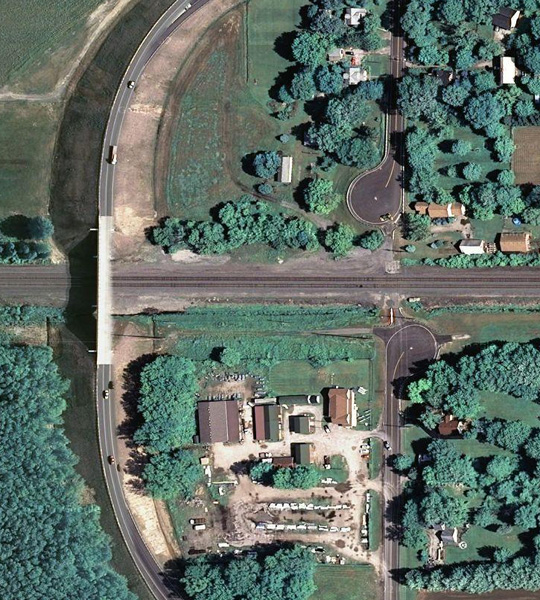
Look at that! The right half of the bridge is already falling apart! It's as if someone took a Photoshop soft eraser to the northbound lane!
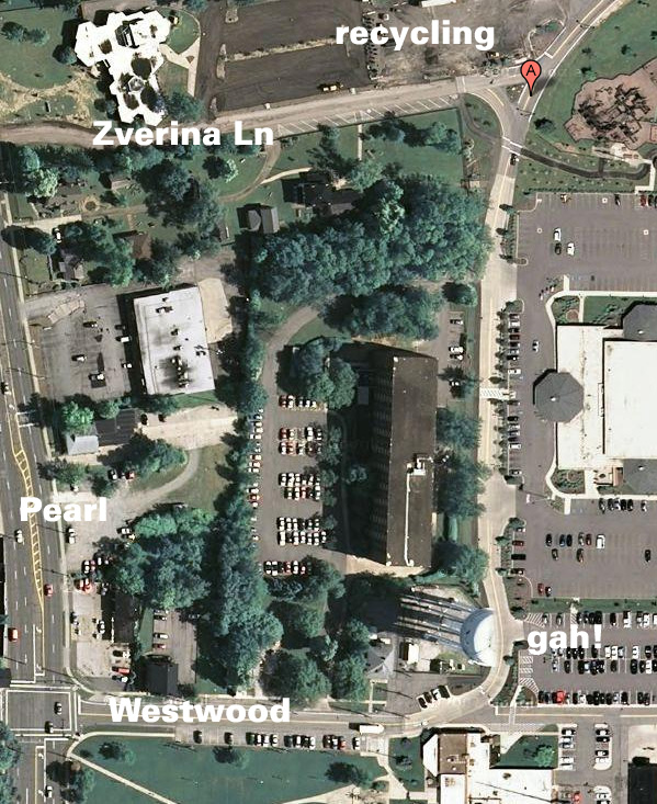
I kid, of course. I presume it's an artifact of how Tele Atlas stitches their satellite photos together. It reminds me of the time I was showing Stu where the recycling bins were in Strongsville, and noticed that the city only had half a water tower:
Frankly I'm just impressed that Google Maps even knows about the "new" Avon-Belden route; I wish my GPS were that up-to-date. My apartment's street doesn't even exist on my GPS, and Cherry Tree Drive is marked as the driveway for the apartments next to me, which is actually just an extension of Whitney Road. I've submitted the correction to TomTom, but haven't seen an update yet.
Interestingly (well, to me anyway), Google Earth had this same error, but Google Maps did not, because they used map data from different sources. I say "did," past-tense, because I see Google Maps is now using Tele Atlas as well, and likewise shows the incorrect Cherry Tree Drive. Annoying.

3 Comments:
I work for Tele Atlas, as a field editor in the Cleveland area. Maybe I could correct it for you, if it isn't already corrected. I've been editing on the westside this summer, maybe it already fixed and maybe Google hasn't gotten my update yet.
Cool! Actually I found the Tele Atlas website and submitted the correction, so hopefully that will take care of it. I noticed the real Cherry Tree Drive is on their maps (even including the driveways around the buildings), so I just submitted it as "GPS is off road" and explained things in the comments field.
This is quite interesting, Bryan. We used to drive up this way all the time when both kids were going to an orthodontist in N.R.
Post a Comment
<< Home